Evacuation zones are based on Whistler’s neighbourhoods. In the event of a wildfire or other emergency, residents of one or more zones may be directed to evacuate depending on the situation.
If an emergency is unfolding in or near the community, emergency officials will determine which zones are most at risk depending on the emergency situation. Emergency officials will use the municipal website and local media to notify residents of impacted zones and what they need to do to stay safe.
Depending on the emergency, being safe might mean staying at home, a short trip to a safe location in Whistler, or traveling out of town.
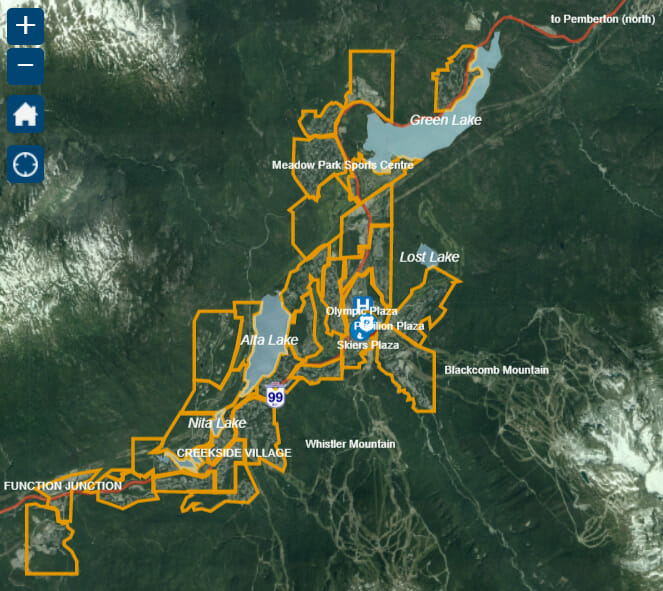
Find your Evacuation Zone
Click on the map below and enter your address in the search bar to find your evacuation zone. Think you know which neighborhood you are in? Whistler’s evacuation zone names and boundaries may be slightly different than the neighborhood names you are familiar with.
How will knowing my Evacuation Zone help?
Evacuation zones allow emergency officials to give specific and actionable directions to residents and visitors in specific areas of Whistler. The zones help people know if they are in imminent danger, avoid unnecessary evacuation travel which will reduce highway congestion, easing overcrowding at reception centres, and boosting public safety.
Evacuation Zones may be used to stagger traffic out of Whistler. The traffic modelling done for the Evacuation Plan indicates that phasing an evacuation, meaning that each Evacuation Zone has a scheduled departure time, will reduce congestion on the highway, making the evacuation more comfortable for travelers.