
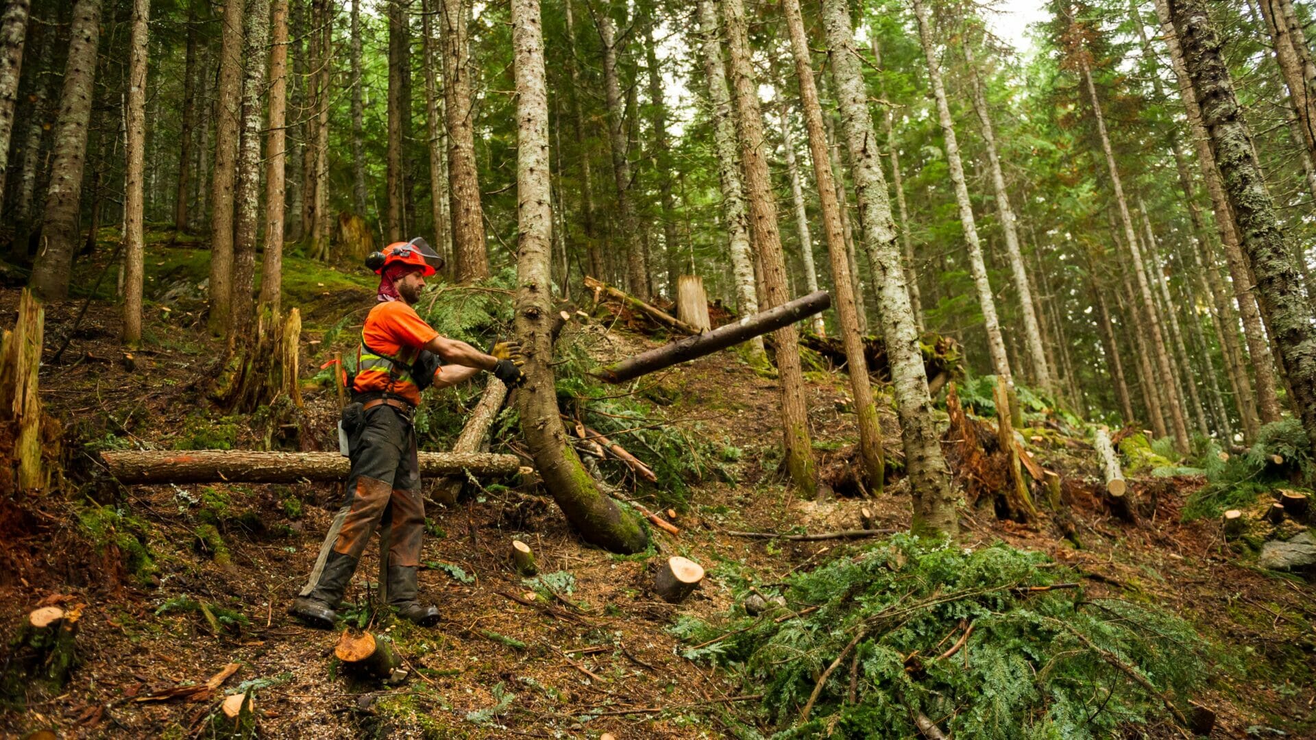
Whistler is surrounded by forest and is at risk for wildfires. Wildfire fuel reduction (reducing the amount of highly combustible organic matter such as trees and woody debris) is one component of Whistler’s Community Wildfire Resiliency Plan and includes techniques such as fuel thinning and fire breaks.
Fuel management in Whistler
The Resort Municipality of Whistler has been conducting wildfire vegetation management projects on Crown and municipal lands since 2004 to reduce the risk of wildfire to our community. The primary goal is to reduce forest fuel loads within the wildland-urban interface to reduce the ability of fire to spread from the forest into the community and vice versa, and to make wildfires easier to fight. Fuel thinning will be discontinued when the fire hazard goes to extreme and will resume when the fire hazard is lower.
Sometimes projects need to burn some of the wood debris. We will alert the public through social media. There is no need to report smoke from fuel thinning projects.
Current Projects
Status
Work is planned for April to October.
Impacts
No be determined.
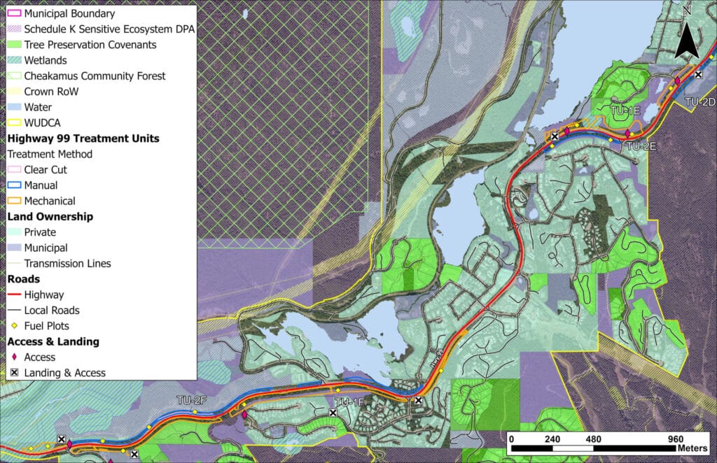
Maps
Green Lake area
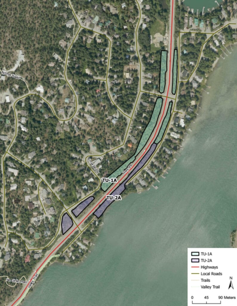
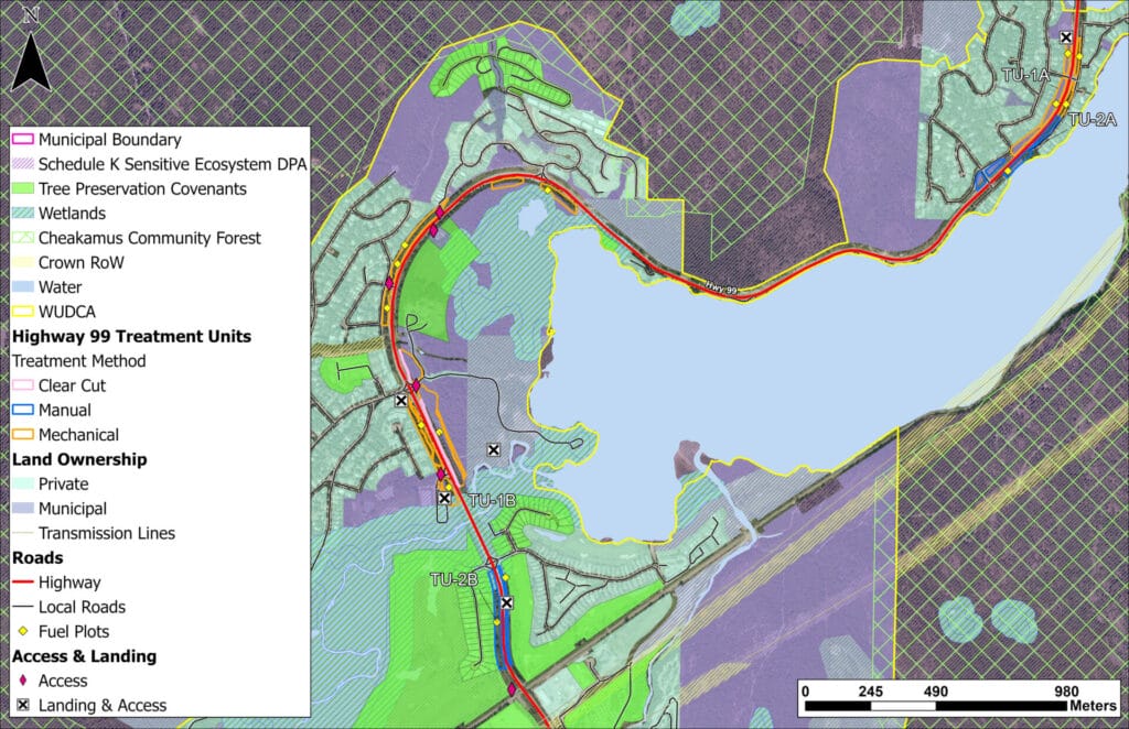
Highway 99 area close to Whistler Village and Whistler Cay
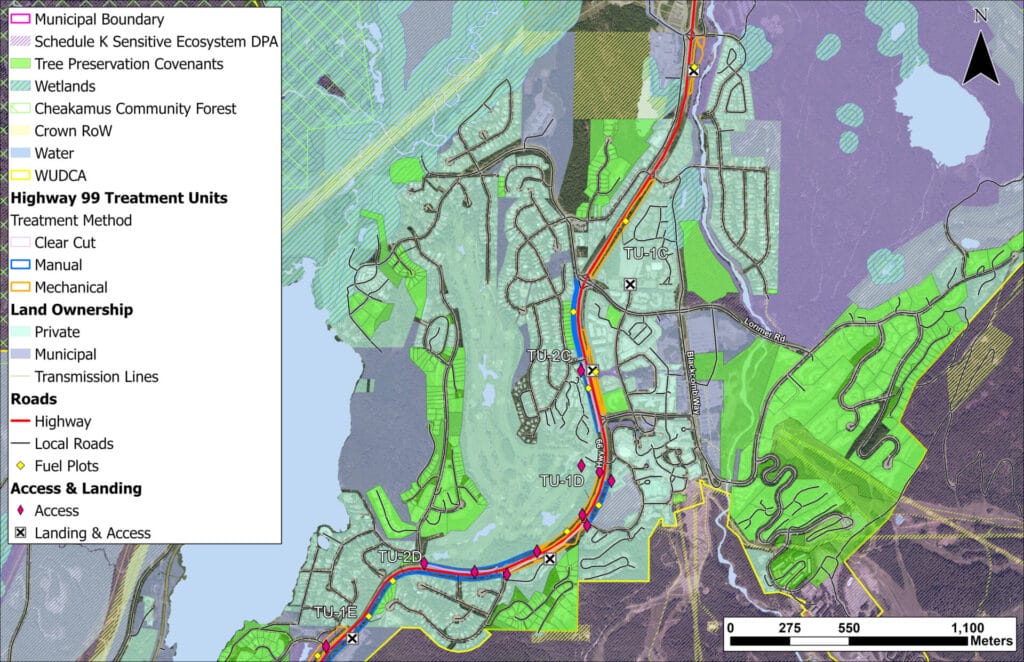
Highway 99 Village to area around Creekside
Status
Work begins on Monday, March 25, 2024 and is slated for completion in June.
Impacts
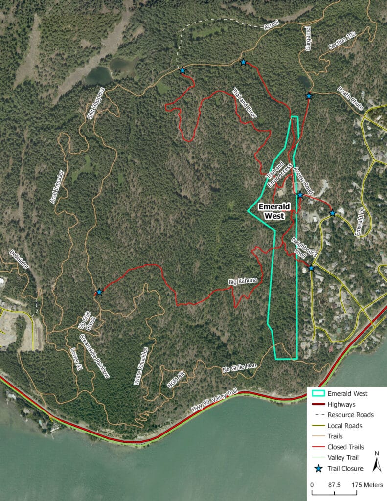
Several trails will be affected, including Trial and Error, Big Kahuna and Neighbor’s Knoll, as well as the Access Road. For your safety, please respect the signs as the contractor will be falling trees and using heavy equipment. Crews will do their best to minimize disruption and all trails will be restored after the work is completed.
Most of the material will be chipped and removed while the project is underway. Some pile burning may be necessary and will only happen during appropriate venting periods in the fall.
Map
View map of area.
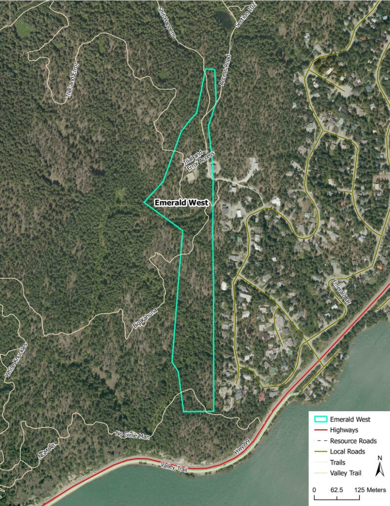
Emerald West project, zoomed out.
Status
Work is planned for June to July.
Impacts
No trails will be affected.
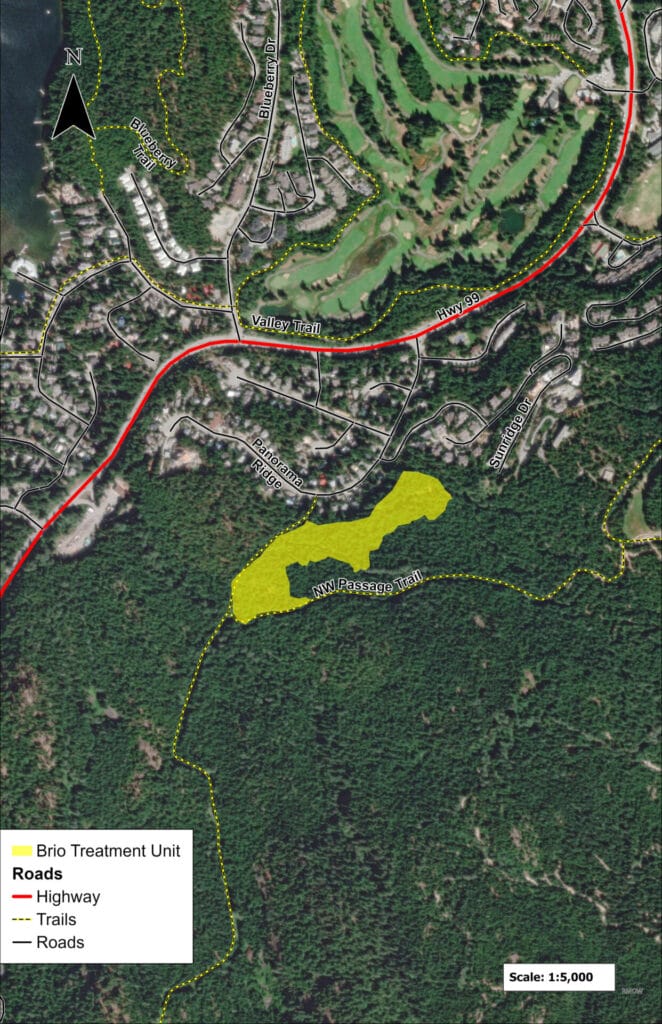
Map
Status
Work is planned for July to October.
Impacts
To be determined.
Map
Completed projects
Process and goals
Vegetation management focuses on leaving mature and deciduous trees, while removing ground brush and debris, pruning lower branches, and removing tight, unmanaged second growth trees. This is accomplished by:
- Reducing the number of trees in the stand to open the upper tree canopy and reduce ability of fire to move from tree to tree;
- Focusing on removal of small diameter trees and retaining fire-resistant species such as old growth, Douglas-fir and deciduous trees;
- Reduce fine woody surface debris, while retaining larger coarse woody debris for habitat and soil productivity;
- Pruning trees to reduce ladder fuels between the ground and the forest crown; and
- Removing dangerous trees to protect workers, while maintaining high value wildlife trees where possible.
In addition to reducing forest fuel loads, secondary objectives are to protect critical infrastructure and facilities in Whistler, restore open forest conditions and demonstrate the principles and practices of the FireSmart program.
Fuel breaks
The RMOW completed a study in 2012 which was incorporated into the Community Wildfire Resiliency Plan to identify where landscape level fuel breaks should be created along forest service roads around Whistler. The focus is on reducing tree densities in unmanaged second growth, rather than removing old growth or deciduous trees. Thinning stands within 100 – 200 m of each side of the road reduces the fuel available to feed fire growth and creates safer, defensible areas for firefighting crews to work in.
Contact
Manager of Climate and Environment
Luisa Burhenne
lburhenne@whistler.ca