Whistler offers hundreds of kilometres of multi-use trails, ranging from easy gravel trails to some of the best singletrack mountain biking in the world. While trails can be found everywhere around Whistler, major areas include Lost Lake Park, the Whistler Interpretive Forest, Train Wreck, and the West Side.
Trails are also available for use year-round, including snowshoeing in the winter months.
Trail updates
From October 10, some washrooms, dog bag dispensers and garbage service will be closed for winter until April 2026.
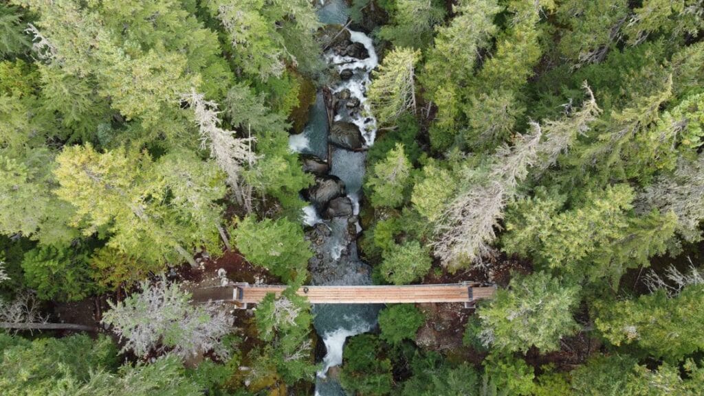
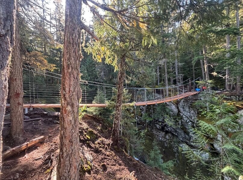
Comfortably Numb trail bridge replacement
The new cable suspension Wedge Creek Bridge (Al Grey Memorial) on the Comfortably Numb Trail is open!
Sea to Sky Trail adaptive mountain bike improvements between Bayly Park/Train Wreck parking south to the Cheakamus River Suspension Bridge are complete!
We have completed upgrades on a two-kilometre section of the Sea to Sky Trail. The section runs from Bayly Park/Train Wreck parking south to the Cheakamus River Suspension Bridge.
Trails are open for hiking and snowshoeing in the winter months. Please note that a pass is required to use marked cross-country ski and snowshoe trails in Lost Lake Park (PDF) during the winter.

Lost Lake Park
Lost Lake Park has an extensive network of multi-use hiking and biking trails maintained by the Resort Municipality of Whistler, with a progression of trails ranging from green doubletrack beginner trails like Tin Pants and Molly Hogan to intermediate trails like the Zappa Trail network.
Please note that there may be closures and diversions due to tree thinning, trail maintenance, and the annual Western Toad migration.
Lost Lake Park also offers Nordic skiing and snowshoeing in winter months. A pass is required to access these trails, and during Nordic operations the trails are closed to all other users.
Getting there
Lost Lake is located north and west of Whistler Village. The main entry is near the corner of Blackcomb Way and Lorimer Road, with parking in Day Lot 5.
It can also be accessed:
- Riding a bike or walking from the PassivHaus, Spruce Grove Park or Nicklaus North neighbourhood
- Using free public transit to the beach area during summer months area
- Note the small parking area at the beach is only available to the public in spring and autumn.
- View map (PDF)
- Trailforks trail maps
- E-bikes aren’t allowed on hiking-only trails. Click here for Whistler’s e-bike policies.
Whistler Interpretive Forest
The Whistler Interpretive Forest area offers a variety of hiking and biking trails, including new singletrack options that extend all the way to the Cheakamus Lake trails network.
Getting there
The Whistler Interpretive Forest is located to the south of Highway 99 at the Function Junction/Cheakamus Crossing intersection. The main parking lot will be just off the highway on your left, with overflow parking available further along the road.
For more information
- View Trailforks trail maps
- E-bikes are not permitted on hiking-only trails. Click here for Whistler’s e-bike policies.
Train Wreck
The Train Wreck area offers an easy, all-season hike with options for technical mountain biking and access to the Sea to Sky Trail.
The gravel travel option is 2.6km and features a suspension bridge over the Cheakamus River to the site of the original 1956 train derailment. View map (PDF).
Getting there
Turn south off of Highway 99 and follow the Cheakamus Lake Road to the Legacy Way intersection. Go right onto Janes Lake Road. The main parking area is on the right side of the road
For more information
- View Trailforks trail maps
Singletrack mountain bike and hiking trails
Intended as a recreational cross country bike ride, rather than a commuting option, Whistler’s singletrack includes a mix of intermediate and advanced trails. Popular singletrack trails include trails in Lost Lake Park (PDF), as well as Cut Yer Bars, Emerald Forest, and River Runs Through It.
- Bike trail maps can be found at Trailforks
- Alternatively, download the Valley Singletrack Route Map (PDF), showing some of the suggested routes.
- E-bikes are not allowed on hiking-only trails. More information on the use of e-bikes in Whistler can be found here.
Mountain Bike Trail Database
- Visit the Whistler.com Mountain Bike Trail Database for a detailed overview of trails, their locations and degree of difficulty, or see maps and details at Trailforks.
- Visit the Whistler Off Road Cycling Association (WORCA) for further trail information, including a link to the Whistler Mountain Bike Trail Guide.