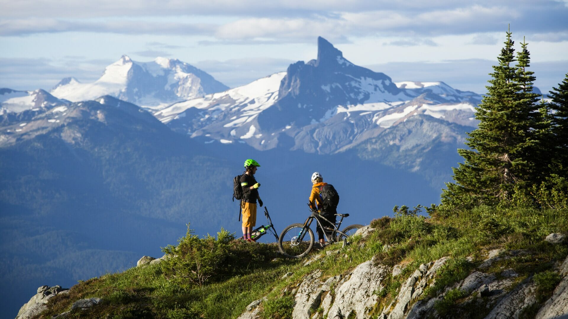
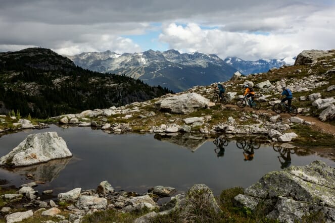
The Resort Municipality of Whistler and other partners have developed a network of hiking and mountain biking trails on Mount Sproatt and Rainbow Mountain to offer a summer backcountry alpine experience like no other. The network includes more than 40 kilometres of alpine trails.
Due to snow melt and weather conditions, the Alpine Trail Network typically opens around late July or early August, and begins to close in October. Current trail reports are available at trailforks.com.
The Resort Municipality of Whistler (RMOW) is reminding everyone to be adventure smart, respect the environment and be bear aware when accessing the network. Both black bears and grizzly bears live on Mount Sproatt and Rainbow Mountain.
Please stay on the marked trails and be prepared for changing conditions. As in the past, dogs are prohibited from the network, and e-bikes are not permitted above Flank Trail. No bikes are permitted on Rainbow Lake Trail or Skywalk Trail.
The Alpine Ranger program has rangers on-site seven days a week for the summer season. Rangers are responsible for monitoring and maintaining trails, providing public information, collecting data on wildlife and recreation users, first aid and communication with RMOW staff and partners, including the Conservation Officer Service, Search and Rescue and Provincial Biologists.
Mount Sproatt Trails – Multi-Use
The following non-motorized multi-use trails are currently available on Mount Sproatt:
- Into the Mystic (8.6 km)
- With a Twist (3 km)
- Pot of Gold (3.4 km)
- Ninja Lakes Loop (2.5 km)
- On the Rocks (3.6 km)
- Rush Hour (1 km)
- Happy Hour (2.5 km)
- Last Call (1.7 km)
- Lord of the Squirrels (6.9 km)
- LESS (Lower Elevation Short Squirrels) (1.7 km)
These trails are used primarily by mountain bikers, but are open to hikers and trail runners.
Dogs are not permitted on the Mount Sproatt and Rainbow Mountain Alpine Trail Network to minimize potential conflict with wildlife.
E-bikes, commercial and special event use are not permitted on these trails (i.e. anything above Flank: Lord of the Squirrels, Into the Mystic, With a Twist, On the Rocks, Happy Hour, Pot of Gold, LESS & Don’t Look Back). The reason for this is to support environmental considerations, user safety and grizzly bear management in the alpine.
Electric adaptive mountain bikes (which are adapted for users with limited mobility in their limbs from spinal cord injuries or other disabilities) are permitted anywhere that regular bikes are allowed.
Learn more at whistler.ca/ebikes.
Download a brochure explaining tips, rules and etiquette for riding e-bikes in Whistler.
Into the Mystic, the primary ascending trail, starts at the 985 m elevation off the Flank Trail and has a Blue Square trail difficulty rating, but requires significant effort due to its distance and elevation gain. A challenging climb over 8.6 km leads to the Alpine Ranger Cabin and the junction of With a Twist and On the Rocks, at 1650 m of elevation. At the Alpine Ranger Cabin there is a urine-diversion toilet. On the Rocks gains another 155 m over 3.7 km before intersecting with Lord of the Squirrels and Happy Hour.
Lord of the Squirrels is the primary descending trail off of Mt. Sproatt and is a steep single-track trail with a Black Diamond trail difficulty rating leading back to Into the Mystic. Happy Hour leads to the summit of Mt Sproatt (1775m).
LESS provides a lower elevation 1.6-km connection between Into the Mystic and Lord of the Squirrels. LESS is ideal during periods of alpine closures and for those who are seeking a less physically challenging climb or are running out of daylight.
Riders should allow two to three hours to ascend to the top of Into the Mystic, and two to three hours to traverse to and descend Lord of the Squirrels.
All trail users should be mindful of preferred trail direction: Lord of the Squirrels is primarily a downhill mountain bike trail. Uphill users should use caution (keep your head up and ears open) and yield to downhill users.
Free maps and current trail reports are available at trailforks.com.
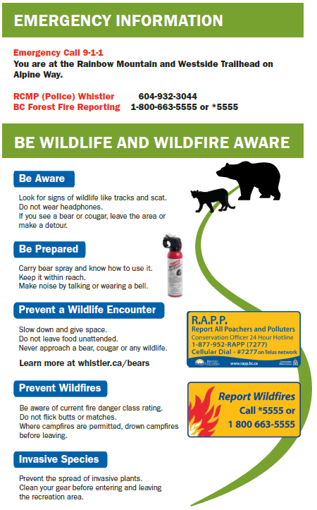
Be bear aware and prepared.
Rainbow Mountain Trails – Hiking Only
Please note: These are hiking-only trails. They are not built for and cannot withstand any type of bike.
Rainbow Falls Loop Trail
The multi-use Rainbow Falls Loop Trail starts and finishes at Alta Lake Road trailhead. There is a car park, wayfinding signage and pit toilet. The trail loop is 2.1 km (gaining 150 m elevation), crosses 21 Mile Creek bridge at the mid-point and descends on the other side.
Rainbow Lake Trail
The Rainbow Lake trail starts at Alta Lake Road trailhead. The multi-use trail turns into a hiking-only trail just above the Flank trail at 21 Mile Creek at the 800 m elevation. This 8 km one-way trip climbs 850 m into the municipal water supply area.
Because most of the trail and Rainbow Lake are within the water supply area, bikes and dog are not permitted, and users are required to:
- Stay on the trail.
- Use designated washroom facilities.
- Stay out of the lake.
Camping is not permitted within the water supply area, but is provided at Hanging Lake. Hanging Lake is located outside of the water supply area and 2.2 km beyond Rainbow Lake.
E-bikes, commercial and special event use are not permitted on these trails. The reason for this is to support environmental considerations, user safety and grizzly bear management in the alpine.
Hikers should allow six hours for the return trip.
Note: The Beverly Creek Bridge (at approximately kilometre three) on the Madeley to Hanging Lake trail has been washed out. This creek is forageable with 1-2′ water crossings and boulders in low water.
Download the Rainbow Mountain trail map.
Skywalk Trail
The 13.8-km Skywalk hiking-only network starts off of the Flank Trail, where it crosses 19 Mile Creek at the 1100 m elevation. Skywalk climbs and winds through spectacular forest along 19 Mile Creek before entering the alpine. Skywalk offers several full-day route options on the east side of Rainbow Mountain and can be linked with Iceberg Lake and Screaming Cat Lake.
Dogs are not permitted on the Mount Sproatt and Rainbow Mountain Alpine Trail Network to minimize potential conflict with wildlife.
E-bikes, commercial and special event use are not permitted on these trails. The reason for this is to support environmental considerations, user safety and grizzly bear management in the alpine.
Hikers should allow six hours for the round trip.
Download the Rainbow Mountain trail map.
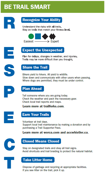
Be Adventure Smart
Residents and visitors alike have a responsibility to be adventure smart by being prepared and always respecting the environment.
Respect the Environment
The Alpine Trail Network passes through the sensitive alpine vegetation. Please stick to the marked trails to avoid damaging the environment.
Learn more about being Adventure Smart when using trails.
Pack out all garbage, use outhouses, take only photos and leave no trace.
Be Prepared
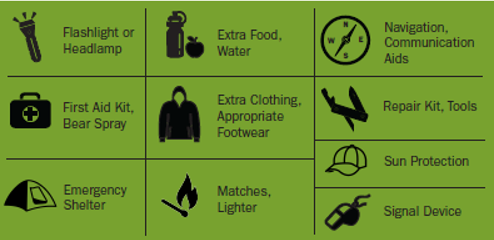
he extensive Alpine Trail Network provides a backcountry experience that requires all trail users to have a high level of fitness and be prepared for a day-long journey in remote, strenuous alpine.
Please ensure bikes are well-tuned and pack spare parts, food, water and appropriate clothing for changing weather conditions. Be prepared for self-rescue.
There is signage and cell phone coverage along most of the trails.
Grizzly and Black Bears
Grizzly and black bears exist in the Whistler area, including the Alpine Trail Network.
All trail users should be bear aware by:
- carrying bear spray (and knowing how to use it in the event of an encounter)
- never hiking or biking alone
- being alert to bear signs (scat, prints, tree markings), and
- respecting trail closures.
Find more information on bear awareness can be found at www.whistler.ca/bears.
Trail Maps
New trail maps including all official hiking and mountain biking trails in the Whistler Valley area have been installed at trailheads and are available online.
Detailed maps have also been provided for:
In the future, smaller tear-away maps for guest service providers and a downloadable GPS-based smart-map will be created.
The RMOW and Whistler Offroad Cycling Association (WORCA) continue to work closely to ensure that trail information is accurate on TrailForks, a free third-party mountain bike oriented trail map app.
Trail Planning and Initiatives
Learn more about the Alpine Trails Program, including planning and initiatives.
Partners and Sponsors
Plans for the Alpine Trail Network were developed collaboratively by the Trails Planning Working Group.
The Trails Planning Working Group now includes:
- Resort Municipality of Whistler (RMOW)
- Alpine Club of Canada – Whistler section (ACC-W)
- Whistler Off Road Cycling Association (WORCA)
- Recreation Sites and Trails BC
- Cheakamus Community Forest
- Squamish Lillooet Regional District
- Association for Whistler Area Residents for the Environment (AWARE)
- Trials BC
- Whistler Blackcomb
Construction of trails was done by staff and volunteers from the RMOW, Alpine Club of Canada -Whistler Chapter and WORCA.
Thank you to the Province of British Columbia’s Resort Municipality Initiative for making this project possible.
Please be aware and TRAIL SMART:
